Sending and receiving text messages via inReach Explorer satellite communicator. Sharing your journey details with family and friends via inReach Mapshare. Unlimited 160-character text messages can be sent to any cell number or email address.
Not enough memory to use it as a fully functioning GPS navigator.
InReach Explorer is multifunctional, reliable, and trendy. No matter where you are, you will always stay in touch with your family and friends. This personal locator is equipped with a digital compass, barometric altimeter, and accelerometer for quick navigation tips. Another modification of inReach Explorer is available.
GPS
Water- and dustproof (IP67)
- 1х Micro USB
- Bluetooth
Built-in lithium ion battery (2450 mAh, 3.7 V)
100 hours in autonomous mode at 10-minute tracking interval
Plastic
Size: 5.8 x 2.5 x 1 inches
Weight: 7.04 ounces
1 year
Color display with precise imagery. Garmin GPSMAP 64st version supports BirdsEye satellite imagery (available upon subscription). This allows you to download images on your device and enhance them with vector maps. Share waypoints, routes, and secret places via Bluetooth or ANT+ technology.
Pretty bulky.
Powerful antenna and high-sensitivity GPS and GLONASS receiver are ideal for quick, precise tracking. Whether you are in deep woods or canyons, your satellite connection will always stay intact. Absolutely no chances for you to get lost with this personal locator. Garmin GPSMAP is available in different versions.
GPS / GLONASS
Waterproof (IPX7)
- 1x mini USB
- 1x MCX connector
- 1x MicroSD card
- ANT+
- Bluetooth
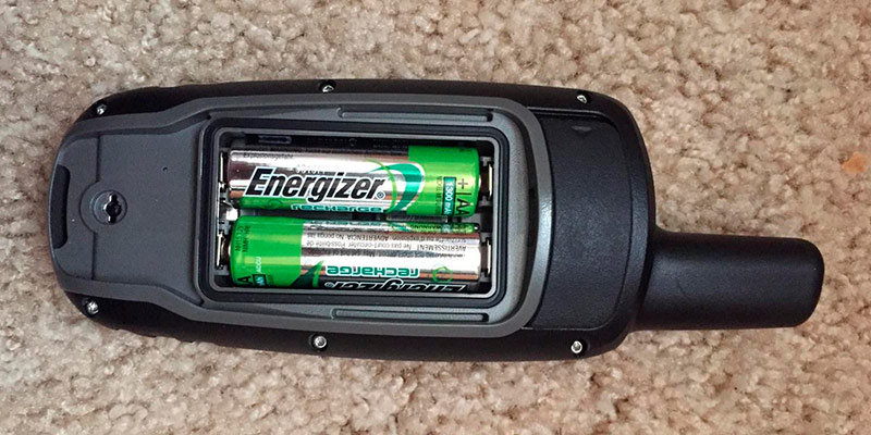
2 AA batteries or NiMH battery pack
16 hours
Plastic
Size: 2.4 x 6.3 x 1.4 inches
Weight: 9.28 ounces
1 year
3-level integrated signal technology (GPS positioning). Powerful 406 MHz signals. 121.5 MHz homing capability. ACR ResQLink device connects you to a worldwide network of search-and-rescue satellites with accuracy and speed.
You need to flip up the antenna manually to use the ACR personal locator beacon.
Self-testing feature allows to check this PLB and ensure that it is fully functioning before the journey.
GPS
Waterproof, 33 ft
N / A
Class 2 (non-hazmat) lithium batteries
30 hours
Shockproof, UV-proof plastic
Size: 1.6 x 1.9 x 4.5 inches
Weight: 4.6 ounces
5 years
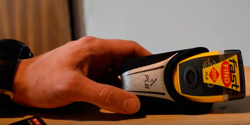
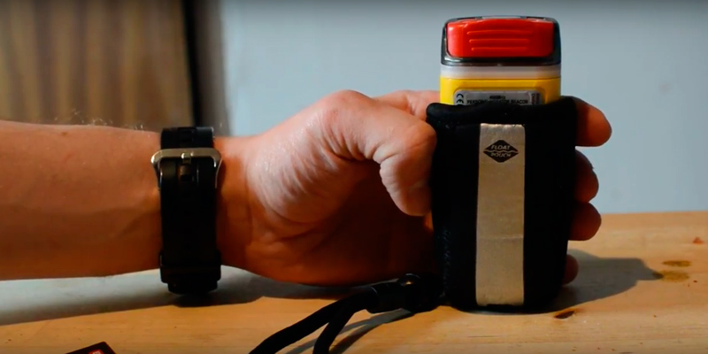
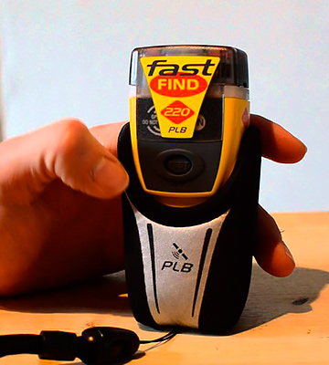
McMurdo Fast Find 220 includes a new bag that enables floating. This PLB works at altitudes up to 40,000 ft. It features a LED indicator to show the GPS connection status.
Batteries should be replaced at the service center only.
A powerful transmitter and a built-in ceramic antenna allow sending a fast and effective SOS signal and coordinates in an emergency.
GPS
Waterproof, 33 ft
N / A
Lithium-manganese battery
Minimum 24 hours
Plastic
Size: 1.34 x 1.85 x 4.17 inches
Weight: 8 ounces
5 years
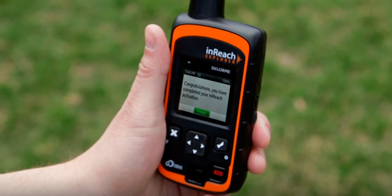
Internal SIM card. One month of free usage (5 Mb). Can be paired with smartphones (iOS, Windows Mobile, Android). Quick pairing via the NFC technology.
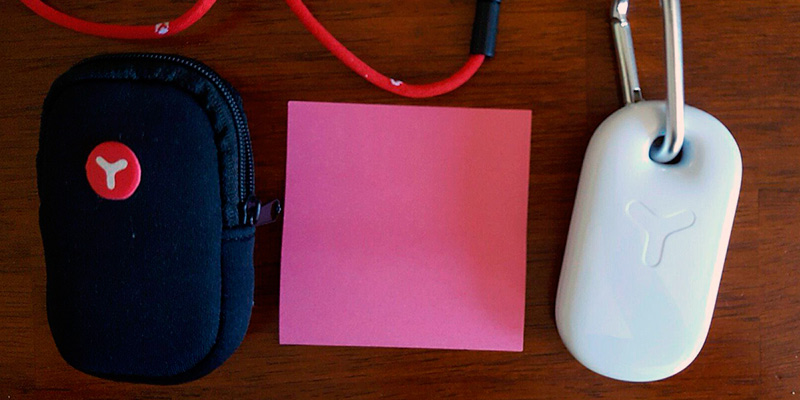
White housing does not repel dirt.
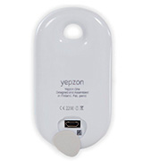
Compared to other devices, Yepzon One GPS locator has an impressive battery life. It is small and stylish, easy to carry in a pocket or wear around the neck on a strap. Ideal for children and elderly people.
GPS / Glonass, GSM Cell ID, BTLE
Waterproof
- 1x Micro USB
- Bluetooth
- NFC
Lithium-ion battery (850 mAh)
From 7-14 days to months (depending on the settings)
Plastic
Size: 0.67 x 1.81 x 3.35 inches
Weight: 1.6 ounces
2 years
This site is a free online resource that strives to offer helpful content and comparison features to its visitors. Please be advised that the operator of this site accepts advertising compensation from certain companies that appear on the site, and such compensation impacts the location and order in which the companies (and/or their products) are presented, and in some cases may also impact the scoring that is assigned to them. The scoring that appears on this site is determined by the site operator in its sole discretion, and should NOT be relied upon for accuracy purposes. In fact, Company/product listings on this page DO NOT imply endorsement by the site operator. Except as expressly set forth in our Terms of Use, all representations and warranties regarding the information presented on this page are disclaimed. The information which appears on this site is subject to change at any time. More info
Delorme InReach Explorer
Two-Way Communication
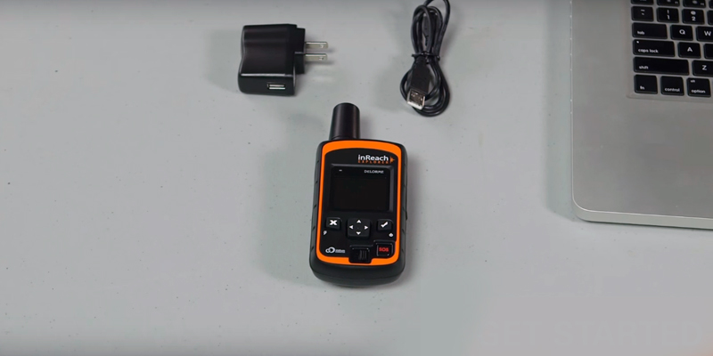
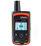
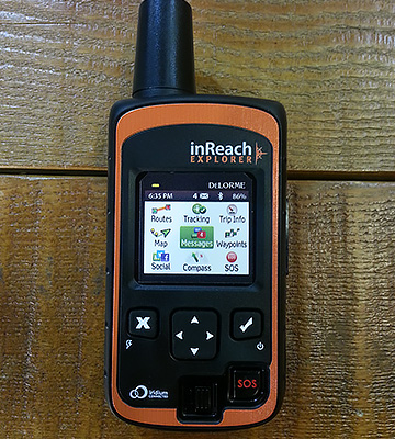
Safety is what makes a perfect journey. One of its vital components is the ability to track any person on a map with great precision. InReach Explorer is a personal locator best suited for these purposes. It functions as a navigator, tracker, and satellite communicator. Note that such combination is very rare for this line of products.
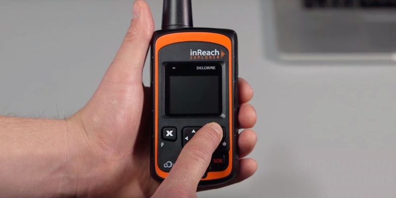
Perhaps the most appealing feature of inReach Explorer is its two-way messaging. It enables sending 160-character text messages via a global network of satellites. You can type your message on the keypad and view it on a well-sized color display. When the message is ready, it can be sent to a cell number or email address. You can also choose personal cell numbers, international rescue service numbers, or email contacts to receive your SOS message.
Another useful feature of inReach Explorer is pairing with a smartphone. This makes the messaging much more convenient, as you enjoy the benefits of a huge screen and better typing options.
Complete Global Coverage
InReach Explorer uses Iridium, a satellite network with 100% global coverage. Your messages will be received from any location, with only slight delays if you happen to be in a dense forest or a deep spot. The 66 space satellites working in pairs provide 24/7 coverage. Messages are sent automatically every 20 minutes, but if you want to, you can send them manually by choosing the Check option in the menu.
Functions as a Simple Navigator
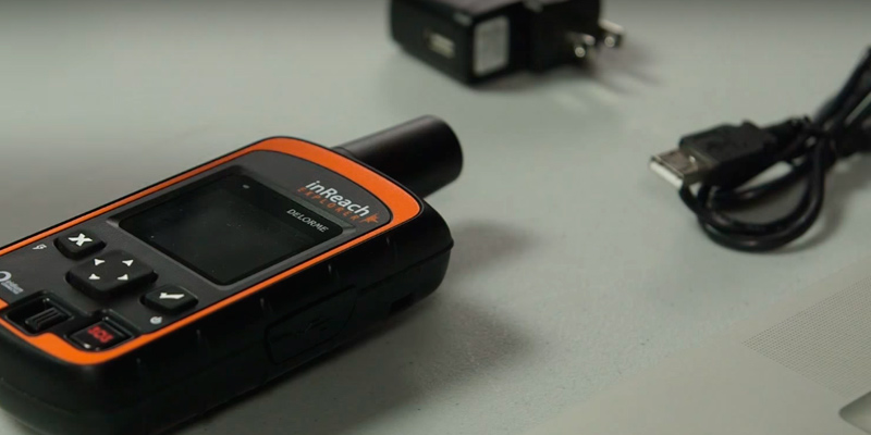
Pairing with smartphones has been done for the previous inReach communicator and continued in the latest version. Bluetooth technology connects the PLB to your smartphone regardless of the OS (Android or iOS). You can even pair your locator with a tablet to enjoy a bigger, better screen.
Your Personal Road Expert
Car GPS navigation systems are essential for a safe and enjoyable road trip. Discover lots of preloaded maps and routes that are always in quick access. Attaching the display to a windshield is easy with a sticky pad.
| Last updated price | $229.00 |
| Stock | In stock |
| ASIN | B00I6EY01C |
What customers say about this product
Key Specs
Map Features
Features
Garmin GPSMAP 64st
Great for Everyday Use
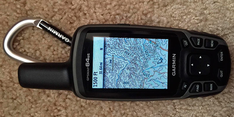
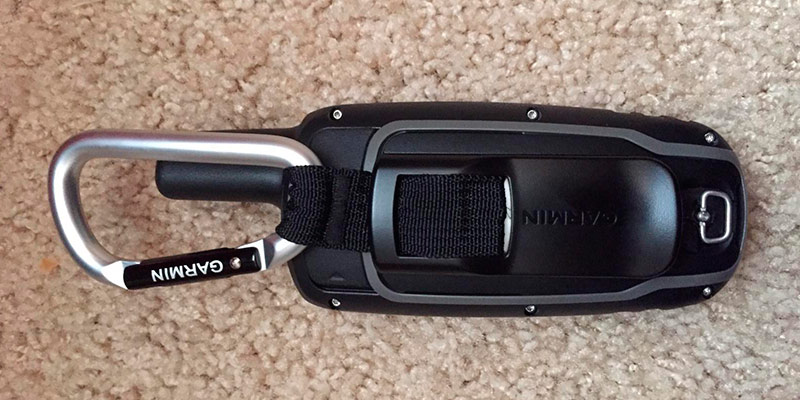
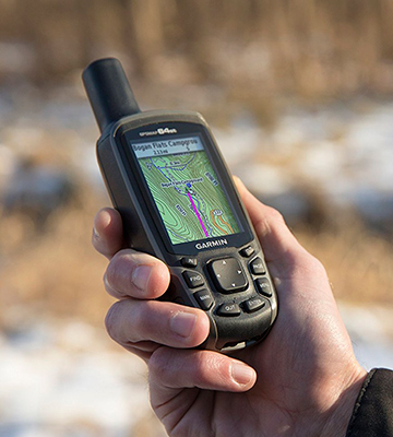
Your daily trips are safe with GPSMAP 64st. The Garmin company is renowned for its car navigation systems and brings you a reliable GPS locator with lots of useful features. This device pinpoints your precise location via the satellite network and puts it on the map. The quality color display is great for better viewing, and you can easily access all functions with case buttons and navigation menu. Quad helix antenna and GPS/GLONASS receiver allow for most effective satellite connection. GPSMAP 64st is also an ideal solution for pathfinding since it features preloaded TOPO U.S. 100K maps. Welcome additions to this navigator are a 3-axis electronic compass and a barometric altimeter that monitors changes in pressure to determine your exact altitude. With these tools, your journey will be as easy as a dream.
Share a Secret Spot
Data sharing is an important feature of every personal navigator. GPSMAP 64st owners can mark their secret places or favorite routes on the map and share them with friends wirelessly (using Bluetooth or ANT+). One push of a button is all you need to send the data to another device – as simple and convenient as this. GPSMAP 64st can be paired with external sensors, e.g. pedometer or pulsometer. Additional options include creating up to 200 different routes for an upbeat traveling experience.
Discover More
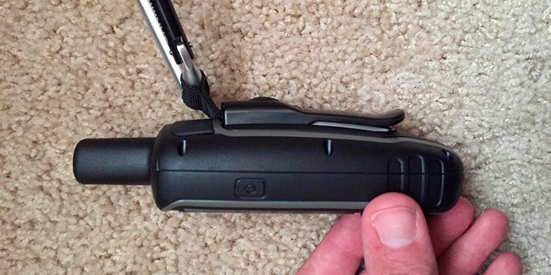
If the preloaded maps and caches are not enough, note that this personal locator supports microSD memory cards. Lots of marine and road maps for many countries will be available to you with this option. Don’t miss the opportunity to store all the latest maps on your device and simply enjoy your vacation. GPSMAP 64st also supports Custom Maps, allowing to easily transform your paper and electronic maps into compatible digital maps. Try this software for free and forget clumsy paper printouts.
Fully Featured
Lighten your backpack by choosing a modern Android smartphone. With maps and hi-res camera, you can rely on this phone as your personal guide and make dozens of amazing pictures and videos. Internet access and your favorite music are another bonus for Android phone users.
Additional Info
| Last updated price | $279.95 |
| Stock | In stock |
| ASIN | B00HWL9BQ4 |
What customers say about this product
Map Features
Key Specs
Features
ACR ResQLink (PLB-375)
Ideal for a Life Jacket
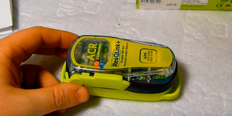
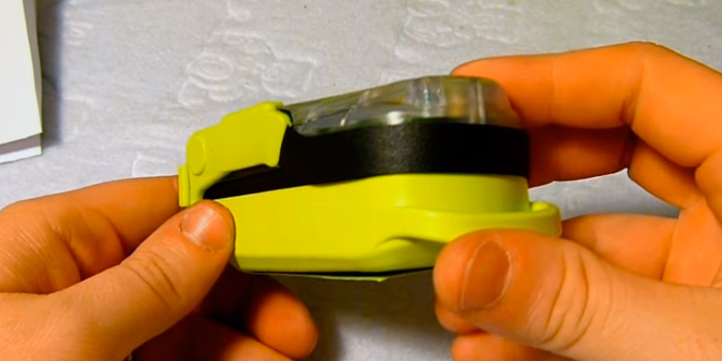
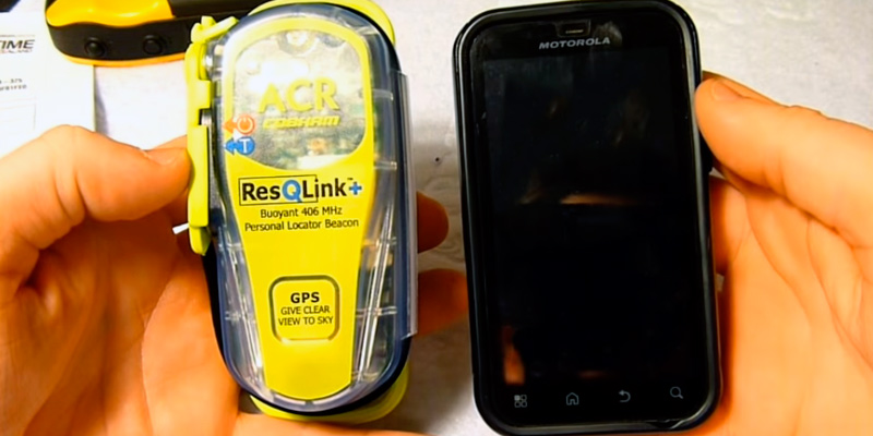
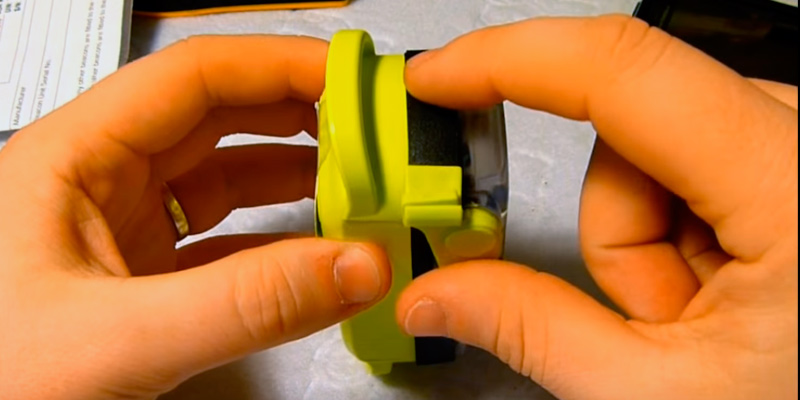
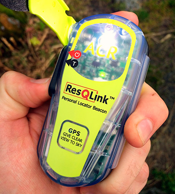
A personal locator can be life-saving in extreme and dangerous situations. If you are looking for one of these devices, check out the indispensable ACR ResQLink. This PLB has a unique design, both practical and compact, which makes it an ideal companion for boaters and hikers. ResQLink connects to a global satellite network, so you can send the SOS signal from any place or country. Flip-up antenna enables receiving a better satellite signal. Due to its flexibility, ResQLink will stay reliable even in extreme conditions.
Highly Reliable
ResQLink is a top-quality solution for extreme conditions with an appealing 5-year warranty. The average battery life is 6 years. Changes in temperature might affect it but only slightly, and the PLB will still be working. Typical performance for this device is 30 hours in signal transmission mode. When batteries are discharged, they can be easily replaced at a service center.
Life-Saving
ResQLink smoothly transmits an encrypted signal to the Cospas-Sarsat satellite system. It allows you to send the data to any cell number or email address. You can inform your family and friends about your location or contact a rescue service. Tracking with ResQLink is very precise, allowing for a fast and effective rescue operation. This device can also serve as a light beacon at nighttime.
Unlimited Battery Life
Batteries discharged on a journey? Solar charges will help you restore the power in your mobile devices. Small but very practical, they are a perfect solution for travel fans.
Additional Info
| Last updated price | $0.00 |
| Stock | May be out of stock |
| ASIN | B006JXY0CQ |
What customers say about this product
Key Specs
Map Features
Features
McMurdo Fast Find 220
Your Personal Rescuer
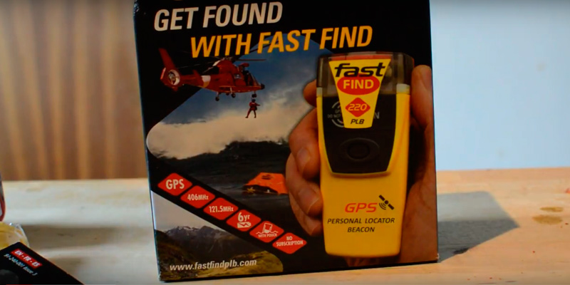
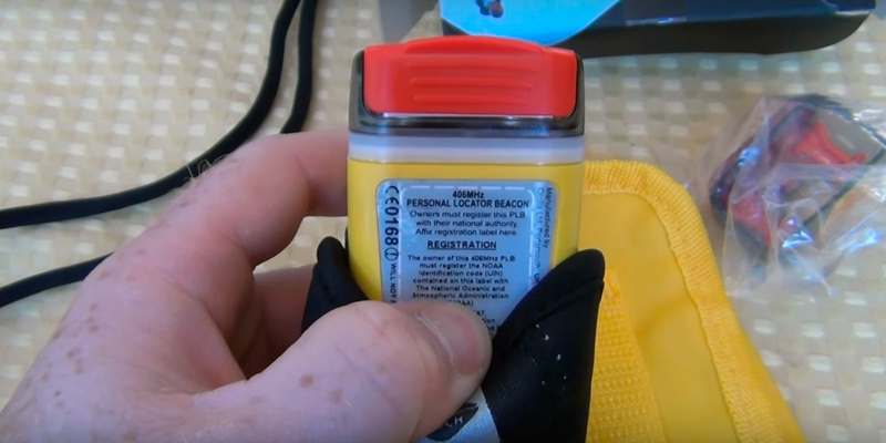
The main purpose of any PLB device is to save lives in situations of grave danger. However, not every personal tracker has the same features as McMurdo Fast Find 220. This PLB can transmit an effective SOS signal via GPS and satellite network. It will pinpoint your location within the impressive 203 ft. The data is transmitted on 406 MHz and 121.5 MHz frequencies, which can be used separately or both at once. These frequencies allow the SOS signal to reach the global network of search and rescue satellites (COSPAS-SARSAT). Just press and hold a button on your tracker, and the rescue team will arrive in no time.
Completely Reliable
McMurdo Fast Find 220 is made of solid waterproof plastic. It easily sustains 5 minutes at a 30 ft depth and sends a clear signal even in a pouring rain. Enjoy up to 6 years of battery life or minimum 24 hours of operating in constant transmission mode. When batteries expire, they must be replaced at a service center, which is the only recommended way to do it. Register your Fast Find 220 tracker online and get an appealing 5-year warranty.
Weatherproof
A good personal tracker must be able to sustain low temperatures. Fast Find 220 works in temperatures ranging from -4 to +131ºF (-20 to +55ºC), which makes it a great choice for summer and winter extremities. To activate your PLB, simply flip up the antenna and press the ‘ON’ button. The indicator starts to blink, twice in 3 seconds for connecting with a satellite and once in 3 seconds upon connecting. One long flash followed by 3 short ones means that your SOS signal and coordinates have been sent. You may want to check your personal locator before the journey by pressing the test button. Secure yourself with this small and reliable device.
Equipped with a Flashlight
Getting lost in a deep forest or on a solo hiking tour is a sad but common experience. You should always have a personal tracker with you to avoid it. Another useful feature of the Fast Find 220 tracker is a LED flashlight to assist you on a night-time journey.
Additional Info
| Last updated price | $232.09 |
| Stock | In stock |
| ASIN | B008OPJGBC |
Yepzon One Personal GPS Locator
Caring for Your Loved Ones
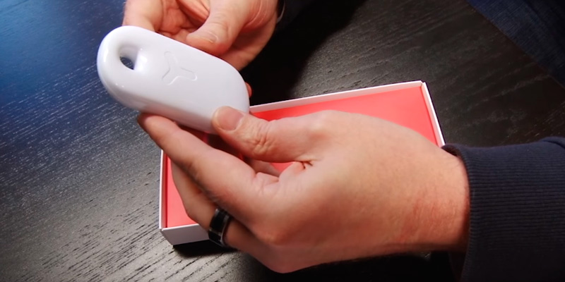
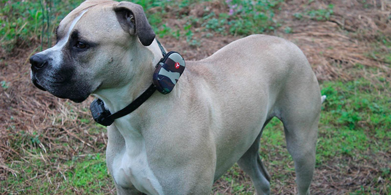
Yepzon is a great solution for parents who care about their children’s safety. This portable device can be worn under the clothes or around the neck on a reliable strap. The strap has a special fastener to prevent suffocation, which is important for small children. If the strap is pulled too hard, it will unfasten automatically. Yepzon can also be used to track your pets and valuables. Attach this GPS locator to your dog’s collar, and you will never lose him or her on a walk. When it comes to design, the smooth plastic case of Yepzon is a real gem. However, cleaning the case can become a nuisance, as it is made in white color – not the best option if you use it on a pet.
Follow Multiple Locators
Yepzon is indispensable for tracking more than one person on the map with great precision. You can follow as many trackers as you want in your Yepzon app. The app requires no passwords or registrations, and you can set it up on any mobile device. Yepzon works with iOS, Windows Mobile and Android operating systems. Your cell phone must support Bluetooth 4.0 or NFC technology to be paired with this tracker.
Extended Battery Life
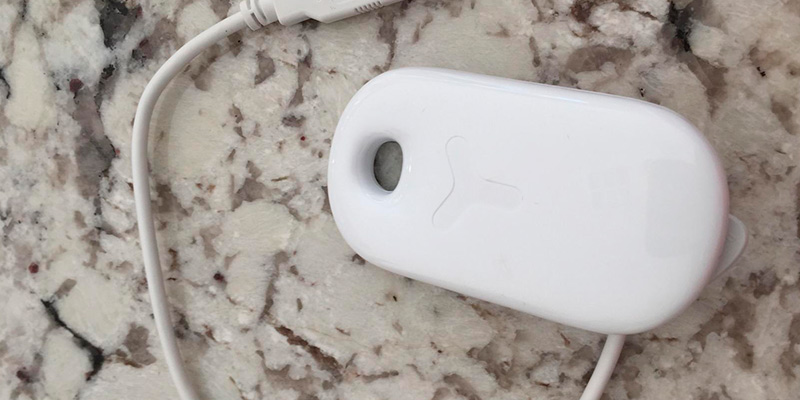
Yepzon has an 850 mAh Li-ion battery with an average life of 1-2 weeks in case of extended use. The device will notify you when it needs recharging. To sum up, Yepzon is perhaps the best personal tracker to be used in a non-extreme setting.
Further Reading
Yepzon includes a charging cable. However, it is relatively short and may not be suited for every occasion. We suggest you read our review of micro USB cables and choose one the best solutions up to date.
| Last updated price | $129.00 |
| Stock | In stock |
| ASIN | B013MB3CBW |
What is a Personal Locator
Personal locator beacon (PLB) is a GPS device designed to locate you in case of emergency. If you get lost on a trip, the PLB will allow you to send an SOS signal. GPS, GLONASS, or GSM technologies are used in beacons to determine your position on the map. As a rule, PLBs are very compact and easy to carry. They can also be used to monitor children – just attach a personal locator to a backpack or put it in your child’s pocket. Some PLBs can be paired with smartphones and controlled from apps.
Worried about your car’s safety? Try using a car GPS tracker. These small devices can be easily hidden in your vehicle. Stolen cars are tracked via a GPS signal from the locator. You can even secure your favorite bicycle by getting a bike GPS. Aside from security features, this locator allows you to set a route and view your location on the map.
What Features to Compare
Tracking
Tracking is the core feature of any personal GPS locator. The accuracy of locating your position by a satellite is very important in case of rescue. If a device supports GPS/GLONASS, your location will be pinpointed with great precision. If, for some reason, GPS is not available, the device will use GLONASS, and vice versa. PLBs with antennas allow for better transmission. Built-in antennas are less effective in PLBs than retractable ones because they are smaller and cannot be flipped up.
Protection
Protection of your PLB is what comes first in an extreme setting. As a rule, a GPS personal locator can sustain about 30 minutes at 3.3 ft under water; your satellite connection will, however, be lost. When choosing a locator, don’t forget to check if it has a water- and dustproof case. Such cases are usually made of lightweight plastic.
If your backpack is bursting with items and stuff, the size and weight of your personal locator will be really important. Full-featured locators usually equal a smartphone in size. Equipped with a display, they enable viewing maps and other data. You can choose between these devices or smaller ones that include only the most essential features but will easily fit in your pocket.
Sources:
1. Steve Tischler PLBs and Satellite Messengers: How to Choose, REI. August 13, 2015.
2. Chris McNamara and Matt Gerdes How to Choose a Personal Locator Beacon or Satellite Messenger, OutdoorGearLab. September 23, 2013.
3. Tom Burden Choosing an Emergency Beacon for Boating or Outdoor Adventures, West Marine. September 17, 2016.
4. Ken Englert How to Choose an Emergency Beacon, Boating Magazine. May 10, 2012.
5. Emergency position-indicating radiobeacon station, Wikipedia.
6. Justin Housman 5 Things You Should Know About Personal Locator Beacons, Adventure Journal. January 13, 2017.
7. Chris Woodward Personal Locator Beacons, Sport Fishing Magazine. August 23, 2012.
Popular Comparisons



Your comment was successfully sent
Error! Please try again later