Product Comparison: Garmin eTrex 20 vs Garmin GPSMAP 62
This site is a free online resource that strives to offer helpful content and comparison features to its visitors. Please be advised that the operator of this site accepts advertising compensation from certain companies that appear on the site, and such compensation impacts the location and order in which the companies (and/or their products) are presented, and in some cases may also impact the scoring that is assigned to them. The scoring that appears on this site is determined by the site operator in its sole discretion, and should NOT be relied upon for accuracy purposes. In fact, Company/product listings on this page DO NOT imply endorsement by the site operator. Except as expressly set forth in our Terms of Use, all representations and warranties regarding the information presented on this page are disclaimed. The information which appears on this site is subject to change at any time. More info
- The color screen really helps keep things visually organized when you have a cluster of waypoints in the same area.
- Saved me rear a few times in the wilderness. love the map tracking ability. I like how it tells you the distance travelled.
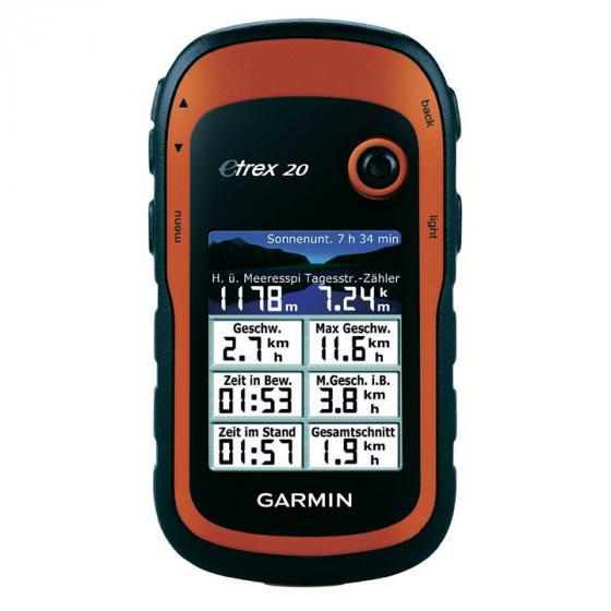
- I'm quite satisfied with the eTrex 20: it delivers great accuracy, quickly locks onto satellites, and seems rugged and durable.
- Has plenty of features for me and seems to be very accurate with great reception.
- Thick forest cover (I'm in Northwest), canyons, cabins, even caves. Locks with no issues where the old eTrex fails and Nuvi is useless.
- As far as GPS goes, I can't imagine having a better unit.
- This GPS unit has a very strong antenna, which allows you to maintain satellite reception even under heavy tree cover.
- Gps functionality works well.
- Nice and easy to create waypoints and routes in Basecamp and load them to GPS unit.
- At around 3000m above sea level it started to completely freak out and show record my position at 0°N and 0°W.


- The basemap exceeded what I was expecting. Major highways & state routes are visible along with bodies of water, and shaded relief of terrain.
- The fact that you can load custom maps onto it is nice.
- This GPS is good for hiking, hunting or any other use where you want to see trails on topo maps, or trace your route.
- Having a pocket-sized GPS receiver that has street-level mapping and routing capabilities is excellent.
- There are lots of free topo maps out there you can load. Good rugged design.
- You don't have to spend any money on maps, however I will probably spend about $60 on a good topographical map, just to take advantage of all the features this GPS has.
- The 24k maps are great and I was happy to save the extra money.
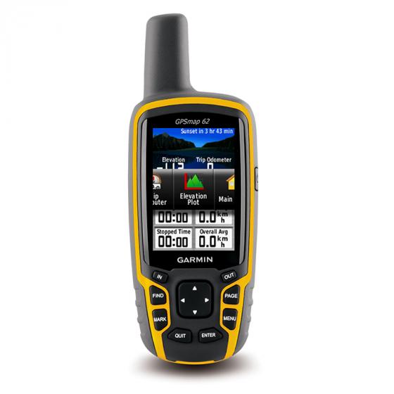
- For maps and outdoor navigation in extreme conditions, the GPSMap is probably the best Garmin unit for this purpose.
- I downloaded a free map set with very little difficulty that seems to work well.
- When moved to the GPS the aerial maps almost exceed the capacity of the unit, so the area of the map is very small if you want to get the most detailed images.


- It's has good battery life, and is also pretty sturdy, and nicely constructed.
- Battery life is pretty decent on it too, I accidentally left it on all night after using it all weekend and it still had battery life left.
- There are so many great features that I doubt I could ever need them all. Obstacles in the water for maritime use. Nearby lodging, or entertainment. Sunrise and sunset Times.
- Great little gps. Bought it because geocaching with my geocaching iPhone app was eating up my data.
- It is light, uses very little battery, will let you upload free basemaps from online sites, and is very accurate with WAAS turned on.
- The screen reads clear under the sun.
- Very accurate, easy to use, intuitive menus and logical button placement.
- Using lithium batteries gives me at least 14 hours of use. Ni-Cad about 10.
- Battery life is not 2 days, unless you use 'battery save' mode, which turns off the screen when idle.
- The number of key presses to do many things related to waypoints is at least 50% larger. Deleting a waypoint requires much more work.
Popular Comparisons


