Product Comparison: Delorme InReach Explorer vs Garmin InReach Explorer (010-01735-10)
This site is a free online resource that strives to offer helpful content and comparison features to its visitors. Please be advised that the operator of this site accepts advertising compensation from certain companies that appear on the site, and such compensation impacts the location and order in which the companies (and/or their products) are presented, and in some cases may also impact the scoring that is assigned to them. The scoring that appears on this site is determined by the site operator in its sole discretion, and should NOT be relied upon for accuracy purposes. In fact, Company/product listings on this page DO NOT imply endorsement by the site operator. Except as expressly set forth in our Terms of Use, all representations and warranties regarding the information presented on this page are disclaimed. The information which appears on this site is subject to change at any time. More info
- This will by no means replace your GPS. It is great as a backup compass and as a raw breadcrumb map that will show you how to roughly get back to where you started.
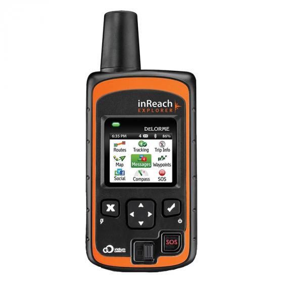
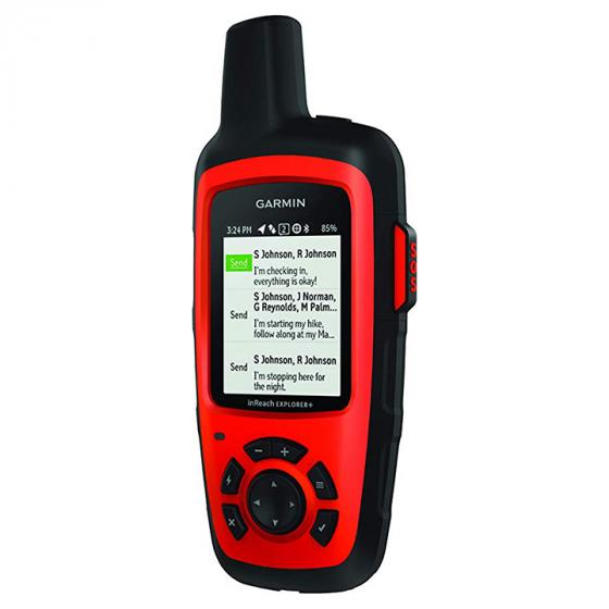
- The screen is small, but surprisingly functional. The interface is a perfect balance of features in a very simple layout.
- Texting communication was great. People were able to use my InReach from the boat to write to anyone they wanted and receive text messages throughout the trip.
- The messages went through and included my exact location and I was able to have 2-way comms with them the entire time in the event by situation got worse.
- Just being able to communicate despite being out of cell phone coverage gave me the reassurance that if anything happened I could be rescued.
- it includes a robust and very accurate GPS navigation system with built-in detailed maps of all of North America and the ability to add more from other places.
- Really like this GPS. I have owned this and a SPOT Gen3 and this communicates with a different satellite network MUCH more easily than the SPOT.
- While I haven't tested the emergency communication, the GPS works well.
- Easy setup on the Garmin website. Peace of mind as I go for mountain bike rides out of cell phone range.


- Detailed tracking below 10 minute intervals works very well on the Explore
- Waypoints, tracking and maps are great especially when tethered to phone. Must download earthmate app.
- It has great mapping features - I love how it lays your location over the map (which includes trails).
- The Earthmate App allows downloading maps via wifi before venturing out, obviating the need for a dedicated GPS and associated electronic maps.
- Delorme provides a great map interface for your contacts that allow them to ping your location in real-time and find it on a detailed map.
- Even better is two way communication and a color gps map where you can download topos and other styles of maps as a back up to a standard handheld GPS.
- Map downloads always use the Internet not the satellite system because of their large size. Additional North American maps always reside on the phone, not the InReach.
- I really should've read the fine print on this device, there are a number of limitations with this device, the most glaring being it does not work with Garmin maps, so any previous purchases or stockpile of data one might have isn't compatible.
- The map is great - I've taken it into the White Mountains of New Hampshire. It included the major trails and landmarks. While the map is a nice feature to have, the Iridium Space Network connectivity is the star of the show.
- The user interface is not touchscreen and the map isn't as ultra bright as newer units, but it works fine in bright sunlight.


- At 10 second intervals, I get a solid active day of battery life. Pairing the Explore with the mobile app enhances this feature.
- Unit has many features and pairs with smartphone to allow control the unit from the phone screen. Sweet setup.
- Texting via pre-made messages, or tether to phone via bluetooth allows you to use your phone's contacts easily to send iridium texts.
- Established waypoints prior to the trip and downloaded maps that were easily viewed on iphone.
- No issues with connecting to the iPhone and utilizing the downloadable maps.
- The subscription is less than $15 per month including taxes. This can save your life as it has for hundreds of people worldwide already.
- One button SOS is included with the ability to have text conversations back and forth with emergency responders.
- The new feature of being able to turn off subscription is also a plus.
- You can also only pay for the monthly plan on months you think you'll use it.
- Had experience with an older model, but this one works a bit better.
Price History
Popular Comparisons


